

Late in the fall of 1864 gold was discovered in a gulch on the west-facing slopes of the Big Belt Mountains. The small stream flowing through the gulch drained into Canyon Ferry Lake. The gold was discovered by four former Confederate soldiers who were traveling south from Fort Benton on the Missouri River. Their destination was the Last Chance Gulch, near Helena. The gold discovery led to the establishment of Meagher County, Montana.
The former Confederate soldiers decided that the gulch would be a good place to stay for the winter. When one of them, William J. Baker from Saline County, Missouri, sank a hole at their camp site, he discovered a piece of gold about the size of a grain of wheat. Higher up in the canyon the men found more gold. Between October 24 and November 19, 1864, fifty-one claims were recorded below the discovery claim of William J. Baker, and twenty-eight claims above the Baker claim.
The discovery place was named Confederate Gulch
After the discovery an anthill of activity occurred in Confederate Gulch, and gold miners arrived almost daily. At the crest of the gold boom 10,000 people lived and worked in the vicinity of Confederate Gulch. For a short while, Diamond City was the largest city in Montana. The Montana population in 1866 was 28,000, and 35 per cent of its inhabitants worked and lived in Confederate Gulch.
A group of Germans arrived in late 1865
A group of Germans immigrants arrived in 1865, led by Charles Fredericks, a former gold prospector from Colorado. Fredericks sank a prospect hole in a clearing on a shelf up from the gulch floor and literally “struck it rich”. The discovery on the shelf became known as the “Montana Bar”. It was not uncommon to get 1,000 dollars of gold from a pan of gravel and dirt on the Montana Bar, at a time when gold was worth less than $20 an ounce. The gold produced on the Bar was one of the richest placer strikes per acre ever made. Soon other rich gold discoveries followed, up and down the gulch.
Gold production at Confederate Gulch between 1866 and 1869 equaled or outstripped production in all other gold mining camps in Montana Territory. According to estimates, a total of between 19 and 30 million dollars in gold was produced. A single shipment of gold in 1866 weighed two tons and had a value of 900,000 dollars. Before 1870 an estimated 15 million dollars of gold was taken out of the earth.
As long as the boom continued
But gold production declined and ran out in 1869 and 1870. Miners and people serving the miners left as suddenly as they had come. At the end of 1870 the population of Diamond City was down to 225 people, and a year later only around 60 people remained. According to Michael P. Malone and Richard B. Roeder, Diamond City was “the most spectacular of Montana’s boom and bust gold towns”.[1]
The creation of Meagher County
Diamond City was part of Gallatin County at the time of discovery. Because of the many people who moved into the place, strong political pressure arose in favor of organizing a new county, with Diamond City as the self-evident county seat. The county was established in 1866 and was named Meagher County. The first meeting of the county commissioners took place on April 2, 1866, and in 1867 Diamond City had 1,500 registered voters. The town continued as the county seat until 1880, when White Sulphur Springs farther east was preferred.
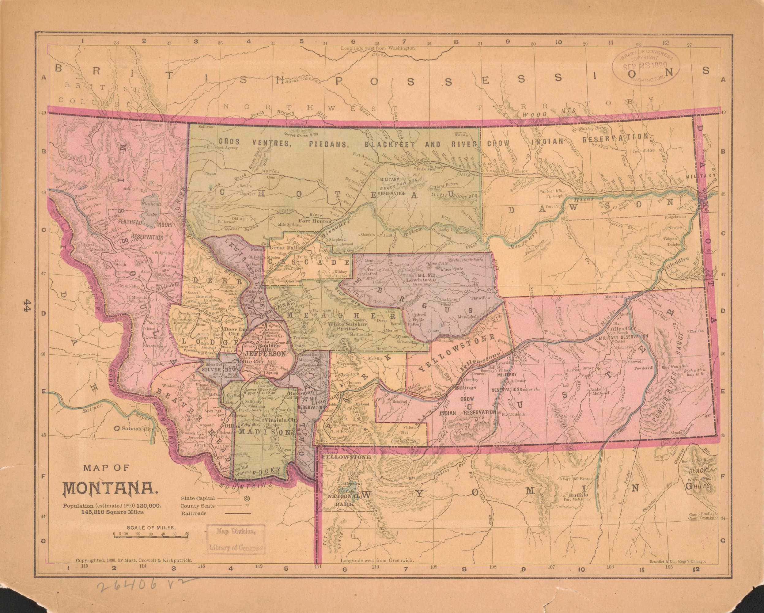
The boundaries of Meagher County were marked by the Missouri River to the west. In the east, the county line was the 109th parallel of longitude. Fergus County was carved out of Meagher County in 1886 and parts of Meagher County was included in Sweet Grass County when that county was established in 1895. Broadwater County was established in the west in 1897, and in March 1911 parts of Meagher County were included in Musselshell County. After strong disputes Wheatland County was carved out of Meagher County in 1917.
From gold mining to ranching
The miners who worked and lived in Confederate Gulch had a growing need for food supplies. Cattle and sheep ranches were established in the region to supply the miners with meat. Even when Diamond City became a ghost city after a few years, ranching remained and expanded.
D. A. Floweree was one of the first to bring cattle to Diamond City. He brought a herd of 65 cattle from Missouri to Montana in 1865. In June 1866 Floweree paid $1,000 for a building on Main Street in Diamond City, and in 1870 he brought 1,500 head of cattle from Texas.
Miners in Diamond City who owned cattle, chose to graze the cattle close to the town. They continued to concentrate on their mining while they left the cattle to take care of itself. During the very cold winters of 1871 and 1872 this type of ranching did not work very well. Three feet of snow covered the ground four months in a row. The cattle had problems finding anything to eat while unattended, and many animals perished.[2] Some people who had recently traveled through the Upper Musselshell Valley reported that they had seen open ground in the area along the river. The wind had blown away the snow.
Would cattle survive the winter better along the Musselshell?
Maybe it was a good idea to move cattle to the Musselshell Valley and see if more cattle survived the winter there? William Gordon, William Alonzo Smith, and William C. Swett combined the cattle they owned into a herd of about six hundred in January 1872 and drove the herd into the Musselshell Valley. It was a strenuous journey, but they could clearly see tall brown grass on the bench land. The men who brought the cattle to the valley, returned to the mines and hoped the cattle would take care of itself.
The Musselshell River
Before 1870 mainly Indians used the river that flowed through the open country between mountain ranges and the Missouri and Yellowstone rivers . “The buffalo was the life blood of the Plains Indian and the Musselshell drainage provided excellent hunting grounds for securing them.”[2] The Blackfeet Indians hunted buffalo and prepared meat for the winter in the Musselshell area. They called it the “Dried Meat River”.
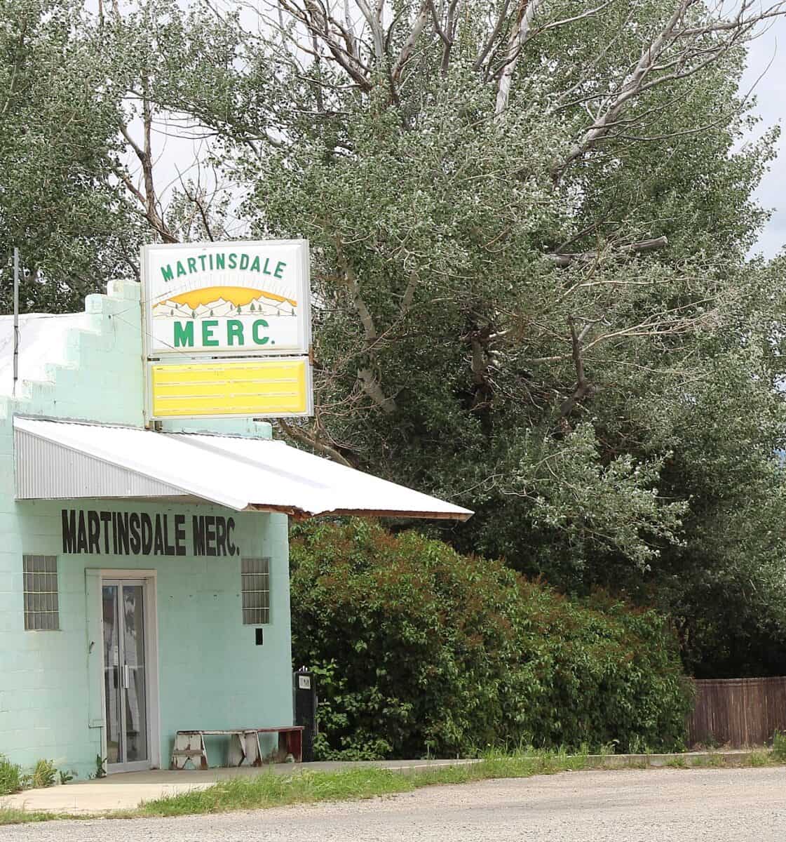
of the Blair Family Museum at Martinsdale.
During the time when the Norwegian immigrant Martin Grande was a big game hunter in the Musselshell area in the mid-1870s, he once experienced that he had to wait three or four days while a big herd of buffalo crossed the river at the headwater.[3] The extension of the Northern Pacific Railroad to Miles City in 1881, brought buffalo slaughter on a big scale to Montana Territory. The naturalist William Hornaday estimated that hide hunters on the northern plains shipped nearly 300,000 hides to the east in the years 81-1883.[4]
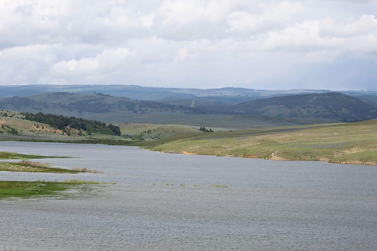
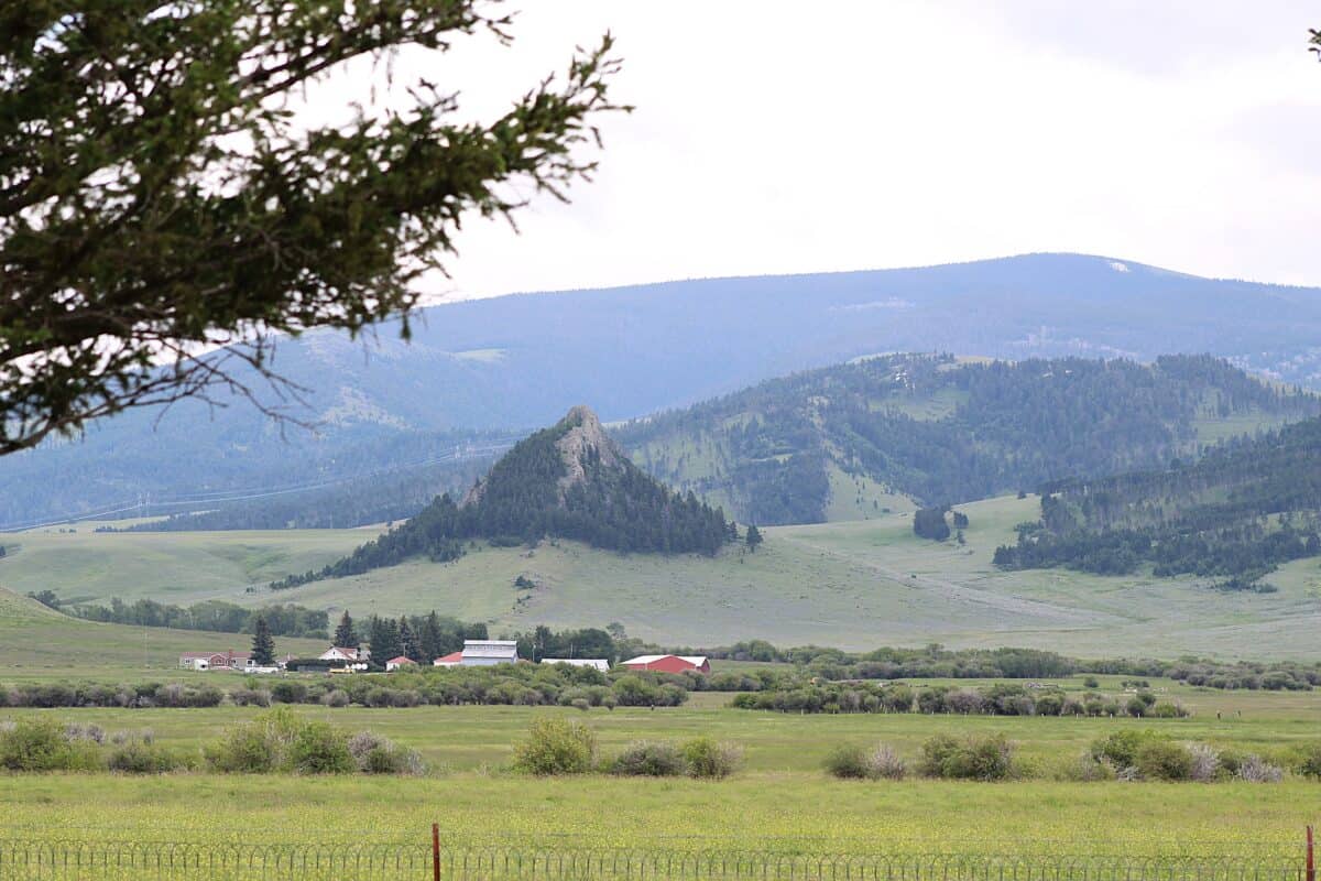
The Musselshell River rises in several forks in the Crazy, Little Belt and Castle mountains in central Montana. The main branch begins at the confluence of the North Fork and South Fork in Meagher County about 25 miles east of today’s county seat White Sulphur Springs, and a short distance east of Martinsdale. From the confluence of these two waterways, the main branch flows roughly 342 miles due east past Two Dot, Harlowtown, and Roundup, before it turns north past Melstone and flows into the Missouri River at the beginning of the Fort Peck Reservoir.
More cattle survived
After the ranchers had rounded up the cattle in spring 1872, branded and counted them, it was evident that more cattle survived in the Musselshell Valley than in the Smith River Valley.[5] William Gordon decided to leave mining and concentrate on cattle instead. He moved with his livestock to the Musselshell Valley, built a log cabin to live in, and a lean-to stable for his horses.
Several ranchers settled permanently in the Musselshell Valley, and by 1874 Perry and Sanford Moore, Ed Sayre, E. J. Hall, William Smith, and J. H. Freezer all had moved their cattle into the Musselshell. At first, they let the cattle graze there in the winter, and moved the cattle back to the Smith River Valley in summer.[6] On November 25, 1875, the newspaper “Rocky Mountain Husbandman” wrote that George Lyons and the Moore Brothers had moved a herd of 1,200 head of cattle to winter in the Musselshell Valley. Around 10,000 head of cattle were in the valley for winter grazing.
Ranchers also began to settle around the hot sulfur springs in the Smith River Valley. The springs were located ten miles east of Camp Baker and about seventy-five miles from Helena. The place got the name White Sulphur Springs and in 1880 it became the county seat of Meagher County.
The first sheep ranches in the Musselshell Valley
At the end of 1875 sheep men had also established ranches along the Musselshell, and Meagher County had about 20,000 sheep. Major William Davenport was one of the first sheep owners. He was born in Bourbon County, Kentucky, and arrived in Diamond City in 1866. Until 1871 Davenport operated the stage and express office and a general merchandise store. Together with his two partners, Thomas A. Ray and A. W. Kingsbury, he imported to Meagher County the first band of sheep east of the Rocky Mountains.[7]
More sheep came every year
The merchant Richard Clendennin moved with wife and children to the fork of the Musselshell in 1877. He opened a store and named the place Martinsdale. Several other new ranches were established in the valley by 1878; some of them were sheep ranches.[8] The brothers William A. and John M. Smith began with 900 sheep in 1875.
George R. (Two-Dot) Wilson moved into the Musselshell Valley in 1877. I. N. Godfrey and Charles W. Cook settled on the South Fork of the Musselshell, and L. D. Burt brought 2,000 sheep to Meagher County in 1878 or 1879. In 1892 Burt lost 18,000 head of sheep out of 30,000 because of wolves, coyotes, and lack of feed.[9] When Ed Sayre began his sheep ranch, he organized a stock company.
J. H. Severance built a house, a large sheep shed and a corral within the first six months after his arrival in the area. Henry Klein of Helena sold sheep to several of the new men in the Musselshell area. R. H. Clendennin, the merchant in Martinsdale, bought 1,130 head from him. J. H. Severance bought 1,500 head and took out 1,000 more on shares with Klein. The buyers paid $3.25 per head, all ewes. In 1879 the sheep population had increased to 60,000 and the cattle to 15,000 in the Smith River Valley.[10] Only three women lived in the valley in 1878, Mrs. George Wilson, Mrs. Richard Clendenning, and Mrs. J. E. Hall.
The pioneer sheep rancher Charles W. Cook
Charles W. Cook was born on February 24, 1839, in Waldo County, Maine. His family sent him to Providence, Rhode Island, to get higher education, but he quit school before his final exams and moved west. At St. Joseph, Missouri, he boarded a steamship for Omaha and then continued to Denver, Colorado. In 1864, he joined a group of eight men driving 125 head of Cherokee cattle from Denver to Virginia City, Montana, where the herd arrived on September 22, four months later.
Cook remained in Virginia City until March 1865, but then joined the stampede of gold seekers headed for Last Chance Gulch in Helena. A month later he moved to Confederate Gulch, where he worked as a placer miner until 1870. He had no great luck and contemplated returning to California. Instead, he travelled to Oregon and bought a band of sheep. He was back in the Gallatin Valley with the sheep in October 1871.[11] Next spring he moved his flock north to Meagher County.
Cook stayed twelve years in the sheep business. When he sold the sheep, he reinvested his money in cattle. Three years later, however, after the disastrous winter of 1886/1887, he turned to sheep raising again. At times he owned as many as 15,000 head of sheep. He finally sold out in 1911; he had by then reduced his flock to 10,000.
Mule trains connected Helena …
The Missouri River was navigable six months of the year to the mouth of the Musselshell River, between three and four hundred miles below the inland port of Fort Benton. The distance from the mouth of the Musselshell to Helena across land was calculated to be around 200 miles.
It was still considered dangerous to travel through the Musselshell region in the 1870s. Unfriendly Indians controlled all the land east through the Yellowstone valley and into Dakota Territory.
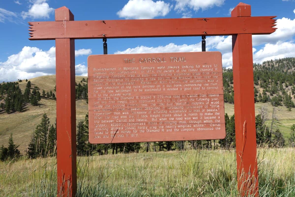
… with the village Carrol on the Missouri River
In 1873 a plan was launched for a wagon road to ease the freight problem from Helena to Fort Buford in Dakota Territory, via the mouth of the Musselshell River. In March 1874 the first “Diamond R mule train” left Helena for the mouth of the Musselshell.[12]
A new village named Carrol was the destination, located some miles upriver from where the Musselshell flowed into the Missouri River. It transported freight destined for the gold fields in Helena from St. Paul, Minnesota, on the recently built Northern Pacific Railroad to Bismark, North Dakota. Bismarck was the end of the railway line until the early 1880s.
Cargo west was loaded onboard steamboats at Bismarck and transported up the Missouri River to the newly built Fort Carroll. Cargo arriving with steamboats at Carroll was transported south by mule trains through the Judith Basin and then west up the Musselshell River to Helena, the center of population in Montana at that time. The mule wagon train used from twelve to fifteen days from Carrol to Helena.
Way stations were set up along the route, east from Helena to Diamond City, the first station was Camp Baker, then Brewer’s Springs, and Carrol. The William Gordon place, near the forks of the Musselshell River, became a stage stop. During the first years, Indians occasionally attacked the mule trains, and especially during the summer of 1875.[13] A post office was established at Brewer’s Springs in July 1875. Stages began to run three times a week from Helena to Diamond City and to Brewer’s Springs and along the Musselshell River to Carroll.
The first roundup in the Musselshell Valley
Several ranchers joined forces and conducted the first roundup ever in the Musselshell Valley in summer 1876. Among the ranchers who joined forces were William Mills, the Moore Brothers, Len Lewis and George Lyons, all ranchers in the Smith River Valley. The ranchers in the Musselshell Valley also started a tradition for rounding up cattle for spring branding.
Many Norwegians established themselves as sheep owners through sheep on shares. Martin T. Grande was one of them. He was the first Norwegian immigrant to settle in this thinly populated area. Grande established his sheep ranch at Comb Creek on the South Fork of the Musselshell River in 1879.

Credits
Map_of_Montana_-_Meagher-county-open-access-scaled-e1711620450127.jpg March 28, 2024. Original image: Map_of_Montana_-_Meagher-county-open-access.jpg
All other images (c) Inger Kari Nerheim
Notes
[1] Michael P. Malone & Richard B. Roeder, Montana. A History of Two Centuries, University of Washington Presse, Seattle WA, 1976, p. 60.
[2] Harold Joseph Stearns, History of the Upper Musselshell Valley to 1920, M.A. dissertation, Univ. of Montana, 1966, p. 5.
[3] Stearns, op. cit, p. 4.
[4] Andrew C. Isenberg, The Destruction of the Bison, Cambridge University Press, Cambridge 2000, pp. 140-141.
[5] Stearns, op. cit, p. 29.
[6] Stearns, op. cit., p. 30.
[7] Stearns, op. cit. p. 43.
[8] Stearns, op. cit., p. 49.
[9] Research worker Alva J. Vinton, Subject. History of Sheep, January 9th, 1941. Assignment no. 6, Special Collections, MSU 230.037, p. 2.
[10] Stearns, op. cit., pp. 49, 51.
[11] Progressive Men of Montana, p. 577.
[12] Stearns, op. cit., p. 34.
[13] Stearns, op. cit., p. 41. Musselshell Valley to 1920, p. 49.
Views: 275